
European Car-Free Urban Models: Implementation Strategies for Enterprise Developers
Europe is redefining its relationship with cars. Several cities across the continent are now recognised as global leaders in car-free urban living, showing how reduced vehicle dependency improves economic performance, environmental sustainability, and long-term urban resilience. · May 19, 2026


Europe is redefining its relationship with cars. The continent is now seeing an expansion of car-free and car-lite districts by reworking the relation between mobility, livability and land use. What was earlier a localized pedestrianization effort across different historic city centers has now evolved into comprehensive urban planning strategies that prioritize public transportation, walkability, and active mobility infrastructure. Today, several cities across the continent are widely recognized as global leaders in car-free urban living, showing the world how reduced vehicle dependency can improve economic performance, environmental sustainability, and long-term urban resilience.
In the past two decades, the number of car-restricted and pedestrian-priority zones across Europe has risen significantly. Cities such as Copenhagen, Amsterdam, Barcelona, and Ghent have implemented structured mobility frameworks that limit private vehicle access, all while expanding multimodal transportation networks. These initiatives are not motivated by heritage preservation or environmental activism. They are backed by data-driven urban transformation programs supported by measurable performance improvements, including reductions in traffic congestion, improved air quality metrics, increased retail footfall, and enhanced public space utilization.
For enterprise developers, these European car-free cities and models help provide strategies that are replicable which are aimed at improving project performance and asset value. Car-lite development frameworks help developers reduce parking infrastructure costs, increase net buildable area, and improve public realm activation. These are factors that have a direct influence on leasing demand and real estate valuation.
Studying and understanding how different European cities have successfully transitioned toward car-free urban living helps enterprise developers with actionable insights into zoning optimization, mobility engineering, infrastructure phasing, and stakeholder engagement strategies.
Best Cities for Car-Free Living in Europe – Complete Ranking
European cities have been at the forefront of the global transition toward pedestrian-first and mobility-diversified urban environments. The best cities of Europe have not eliminated cars entirely; instead they implemented layered mobility hierarchies that prioritize public transit density, cycling infrastructure, and pedestrian accessibility while keeping a check on private vehicle circulation in core districts.
Here is a ranking of the leading car-free or car-lite cities across Europe, ranked based on mobility performance indicators including walkability metrics, pedestrianized zones, and transit accessibility.
Top European Cities for Car-Free Living
| Rank | City | Estimated % Car-Free / Restricted Core | Public Transit Coverage | Walkability Score |
|---|---|---|---|---|
| 1 | Amsterdam | ~60% central restrictions | Metro, tram, ferry integration | 95 |
| 2 | Copenhagen | ~80% pedestrian-priority core | Metro + bus + cycling integration | 94 |
| 3 | Barcelona | Superblocks covering 500+ blocks | Dense metro and bus network | 92 |
| 4 | Ghent | 35% circulation-restricted zones | Tram and bus integrated | 90 |
| 5 | Vienna | Extensive pedestrian historic core | 1,000+ transit stops citywide | 91 |
| 6 | Oslo | Parking elimination in CBD zones | Electrified bus + metro | 89 |
| 7 | Freiburg (Vauban District) | Car-free residential master planning | Tram-centered transit | 88 |
| 8 | Strasbourg | 600 km cycling infrastructure | Tram backbone | 89 |
| 9 | Ljubljana | Fully pedestrian historic center | Bus-dominant transit | 87 |
| 10 | Zurich | Strict parking supply caps | High-frequency tram network | 90 |
| 11 | Paris | Expanding 15-minute city mobility framework | Dense multimodal transit | 88 |
| 12 | Venice | 100% historic center car-free | Water transit mobility | 86 |
These cities stand out as global benchmarks that consistently outperform mobility standards thanks to their alternative transport systems. The success of these models lies in having mobility planning, zoning reforms, and long-term infrastructure investment strategies.
Deep Dive Case Studies
Amsterdam – Cycling Infrastructure as a Primary Urban Transport Model

Amsterdam stands out as one of the most prominent examples of cycling-first urban mobility planning. With over 500 kilometers of dedicated, protected cycling lanes forming the backbone of the city’s transportation network, they support approximately 38 percent of daily commuting trips.
Amsterdam’s car-reduction strategy was made possible with incremental infrastructure reallocation rather than haphazard vehicle bans. The city progressively reduced parking supply, introduced traffic-restricting measures, and expanded bicycle storage infrastructure, including major transit-oriented bicycle hubs like the 11,000-space Central Station parking facility.
For enterprise developers, Amsterdam shows how cycling infrastructure must function as a core transport network integrated with transit corridors, retail streets, and residential zoning frameworks to achieve a sustained shift.
Copenhagen – Pedestrian-Led Mobility Planning and Public Space Integration

Copenhagen’s pedestrian-focused transformation began in 1962 with the pedestrianization of Strøget Street. The city initially faced strong resistance from retailers and commuters. Over the next five decades, the city expanded pedestrian corridors and cycling infrastructure, resulting in nearly 80% of its central district prioritizing pedestrian mobility.
Today, approximately 49% of Copenhagen residents use a bicycle to commute. This is supported by dedicated cycling highways, protected intersections, and weather-protected pedestrian streets. The city’s public design brings together ground-floor commercial activation, wide walkways, and climate-responsive street furniture to encourage pedestrian engagement.
Copenhagen shows that pedestrian infrastructure requires both physical street redesign and retail programming alignment to sustain economic activity.
Barcelona – The Superblocks Urban Circulation Model

Barcelona’s superblocks (Superilles) represent one of the most innovative car-reduction frameworks in urban planning. The city reorganized nine-block clusters into pedestrian-priority zones while redirecting vehicle traffic to surrounding arterial roads.
This improved public space accessibility by almost 40% and lowered NO2 concentrations by about 33%. Retail and local economic activity in superblocks also grew as a result of enhanced pedestrian accessibility and improved usability of public spaces.
For enterprise developers, Barcelona shows the importance of block-scale mobility redesign and phased infrastructure implementation when transitioning toward car-lite development models.
Ghent – Traffic Circulation Governance Strategy
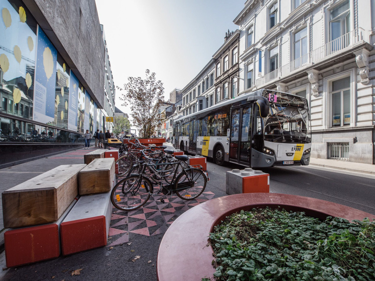
Ghent brought forth one of Europe’s most effective policy-driven car-reduction strategies through its traffic circulation plan. The city divided its central area into six traffic sectors where vehicles cannot travel directly between zones without using peripheral ring roads.
This approach decreased vehicle traffic in the inner city by 17% in its initial year and boosted cycling usage by 12%. Significantly, Ghent preserved vehicle access for residents and businesses, demonstrating that car-free city planning can align with effective service logistics.
Ghent’s approach provides enterprise developers with a model that emphasizes governance and traffic management over large-scale infrastructure reconstruction.
Venice – Historic Car-Free Urban Model

Venice stands out as an example of a car-free urban environment thanks to its geographic constraints rather than contemporary planning policies. The city’s historic core relies entirely on pedestrian circulation and water-based transit systems.
Despite its historic origins, Venice offers important operational lessons for modern car-free districts, particularly in freight logistics, service accessibility, and density-based amenity distribution.
For enterprise developers, Venice shows the importance of integrated service and logistics infrastructure when designing large-scale pedestrian urban districts.
Key Success Factors
Infrastructure Requirements
Car-free districts depend on a complex and layered mobility infrastructure that supports reliable, efficient alternatives to private vehicles. European cities consistently show how infrastructure readiness is the most critical success factor in sustaining pedestrian-priority urban environments.
Public Transportation Systems
High-capacity public transportation networks become the backbone for cities that want to reduce dependency on cars. Cities like Vienna and Zurich maintain transit stop densities that exceed 18–20 stops per square kilometer, ensuring most residents remain within a short walking distance of public transport.
Enterprise developers looking to emulate car-free models must prioritize site selection close to high-frequency transit corridors or include transit infrastructure within the master planning framework. Transit-oriented development zoning increases residential density while reducing dependency on vehicular ownership.
Cycling Infrastructure
Cycling infrastructure across European car-free cities takes the role of primary transportation rather than a secondary option. Protected cycling corridors, grade-separated intersections, and dedicated infrastructure improve adoption. Amsterdam’s cycling network spans more than 500 kilometers and supports nearly 40% of daily commuting trips.
Developers incorporating cycling-first planning can reduce internal road widths and parking demand while improving accessibility metrics. Cycling infrastructure must be designed as a continuous network rather than isolated corridors to achieve sustained usage.
Pedestrian Networks
Pedestrian infrastructure is critical for car-free urban planning. Most European cities have pedestrian zones that consist of wide walkways, traffic management, and mixed-use street activation. Barcelona’s superblock implementation expanded internal pedestrian corridors by reorganizing traffic circulation patterns, increasing public space availability while maintaining access for emergency and service vehicles.
Enterprise development teams must look at pedestrian infrastructure as economic activation infrastructure rather than purely recreational public space. Ground-floor commercial activation, shading infrastructure, and accessibility together significantly improve pedestrian engagement and usability.
Last-Mile Connectivity Solutions
Car-free districts depend heavily on last-mile mobility solutions to bridge transit access and final destination travel. European cities make use of shared micro-mobility services, cargo bike logistics, and electric shuttle systems to maintain accessibility within pedestrian districts. Copenhagen’s pedestrian-focused hubs use bike-sharing, electric scooters, and integrated transit ticketing to improve multimodal accessibility.
Enterprise developments must account for last-mile mobility infrastructure early within their master planning frameworks to maintain service accessibility and reduce reliance on private vehicles.
Policy and Regulatory Frameworks
Infrastructure alone cannot sustain car-free urban environments. European cities achieve long-term mobility transformation through coordinated policy frameworks that regulate land use, parking supply, and traffic circulation.
Zoning Regulations
Mixed-use zoning is a fundamental policy mechanism supporting car-free development. The 15-minute city planning model, widely implemented in Paris, uses zoning regulations that prioritize accessibility to daily services within walkable distances. Enterprise developers benefit from zoning flexibility that encourages higher-density mixed-use development around transit corridors.
Parking Policies
Parking reform remains one of the most influential regulatory drivers behind European car-free urban success. Cities such as Zurich and Oslo have implemented parking maximums rather than minimum parking requirements, limiting vehicle storage infrastructure within urban cores. Reducing parking supply allows developers to increase leasable floor area and public realm investment while improving long-term project returns.
Incentive Structures
European municipalities frequently support car-lite development through financial incentives, density bonuses, and public transit investment subsidies. Public-private infrastructure partnerships also allow developers to share transit infrastructure costs while benefiting from improved project accessibility and market performance.
Enforcement Mechanisms
Effective enforcement ensures regulatory compliance within car-free districts. European cities implement congestion pricing, restricted vehicle zones, automated traffic monitoring systems, and controlled service access corridors to maintain mobility discipline. For enterprise developers, regulatory enforcement mechanisms provide operational certainty and protect infrastructure investment outcomes.
Implementation Strategies for Developers
Adapting European Models to New Developments
While European car-free urban districts evolved through decades of policy and infrastructure upgrades, enterprise developers must translate these models into new development environments where mobility frameworks can be integrated from the initial stages. Successful adaptation requires aligning site planning, infrastructure phasing, stakeholder collaboration, and financial modeling within a single mobility-first development strategy.
Site Selection Criteria
Selecting appropriate development sites is one of the most critical factors of car-lite project success. European case studies show that car-free urban districts perform best when located within high-density transit corridors or mixed-use urban growth zones. Key site evaluation factors include proximity to high-capacity public transit zones, availability of mixed-use zoning permissions, and population density thresholds capable of sustaining retail and service infrastructure within walkable distances.
Phased Implementation Approaches
European cities like Copenhagen and Barcelona implemented car-reduction strategies gradually to maintain public acceptance and operational continuity. Initial development phases often incorporate reduced parking ratios and shared mobility infrastructure rather than full vehicle restriction. As population density increases and transit connectivity improves, developers can introduce pedestrian-priority corridors and vehicle-restricted commercial zones.
Stakeholder Engagement Strategies
Public acceptance remains a critical success factor in car-free urban development. Cities such as Ghent successfully overcame resistance through transparent communication strategies supported by performance data. Enterprise developers must engage stakeholders early through participatory planning workshops, mobility simulation demonstrations, and phased policy communication.
Financial Modeling Considerations
Car-free development frameworks significantly alter project financial structures. While reduced parking infrastructure lowers capital expenditure, developers must reinvest savings into public space improvements, transit integration, and mobility infrastructure. European developments demonstrate that enhanced pedestrian infrastructure frequently generates higher retail performance and improved residential demand, offsetting public space investment costs over time.
Technology Solutions
Advanced planning technologies enable developers to design, evaluate, and optimize car-free development frameworks before construction begins.
AI-Powered Mobility Planning
Artificial intelligence-based urban planning platforms allow developers to evaluate complex mobility scenarios. Digital Blue Foam (DBF) helps enterprise development teams to simulate pedestrian accessibility, parking demand, and transit integration across multiple development configurations. By considering alternative mobility strategies during master planning stages, developers can reduce investment risk and optimize land-use efficiency.
Spatial Analytics for Walkability Optimization
Spatial analytics tools help developers evaluate pedestrian accessibility and service distribution within car-lite districts. Developers can use spatial modeling to analyze pedestrian travel time, commercial service coverage, and public space accessibility across master-planned communities. Walkability analytics ensure that residential density, retail distribution, and public infrastructure align with pedestrian mobility requirements.
Simulation and Scenario Testing
Scenario-based mobility simulation empowers developers to test multiple infrastructure configurations before construction. Enterprise developers can simulate parking removal scenarios, traffic circulation adjustments, and transit accessibility improvements to identify optimal development configurations. Integrating AI-driven mobility simulation, spatial analytics, and infrastructure scenario testing allows developers to design car-lite districts that maintain operational efficiency while supporting long-term sustainability and asset performance objectives.
Economic & Social Benefits
Property Value Impacts
Urban spaces that prioritize pedestrians typically showcase strong real estate performance. European cities implementing mobility-first planning frameworks have historically reported measurable property value appreciation in residential and mixed-use developments within walkable zones. Barcelona’s superblock districts recorded residential price increases between 10 and 15% in areas with expanded pedestrian infrastructure. For enterprise developers, reduced parking infrastructure combined with higher-density development potential often increases buildable floor area and leasing revenue.
Retail Performance Data
Retail corridors across pedestrian-oriented European cities have historically outperformed vehicle-oriented commercial corridors. The Strøget corridor in Copenhagen saw retail revenue growth exceeding 30% following phased pedestrianization. Barcelona’s superblock zones recorded retail activity increases of approximately 20% after mobility restructuring. For developers, commercial districts with higher pedestrian volumes generate higher retention rates and support diversified retail programming.
Health and Quality of Life Metrics
European urban environments with limited private vehicle usage have demonstrated significant improvements in public health and social well-being indicators. Reduced vehicle traffic lowers air pollution, while expanded pedestrian infrastructure encourages active mobility behaviors. Studies across multiple European cities show that residents in pedestrian-focused neighborhoods report higher physical activity levels and improved mental well-being. Car-free districts also improve road safety outcomes, with traffic calming design significantly lowering accident rates.
Environmental Benefits
Car-free urban planning directly contributes to climate resilience and emissions reduction goals. Barcelona’s superblock design reduced nitrogen dioxide concentrations by approximately 33%, while cycling-oriented mobility frameworks in Amsterdam have significantly reduced transportation-related carbon emissions. Green infrastructure integration within pedestrian districts further improves environmental performance by increasing tree canopy coverage, stormwater management capacity, and microclimate regulation.
Conclusion
European car-free urban models demonstrate that reducing vehicle dependency improves urban economic performance, public health outcomes, and environmental sustainability together. Cities like Amsterdam, Copenhagen, Barcelona, and Ghent have shown that mobility-first planning frameworks improve retail productivity, increase real estate value, and strengthen community engagement when supported by transit infrastructure and regulatory alignment.
For enterprise developers, implementing car-lite infrastructure requires a structured framework beginning with strategic site selection, transit-oriented zoning integration, and phased mobility infrastructure deployment. Ensuring early stakeholder engagement, parking infrastructure optimization, and investment in pedestrian and cycling networks are critical to sustaining long-term project performance.
As cities worldwide move towards more sustainable frameworks, enterprise developers have the opportunity to replicate proven European mobility strategies while adapting them to local regulatory and market conditions. Making use of mobility engineering, public space activation, and data-driven planning ensures that car-free development projects deliver long-term economic and environmental value.
Developers evaluating car-lite mobility strategies and optimizing master-planned communities should explore Digital Blue Foam’s urban mobility planning tools, which help teams simulate pedestrian accessibility, infrastructure performance, and transit integration across varied development scenarios.
